Reference

Maps & Place Codes

the detailed topographic map, and the two ridge schematics

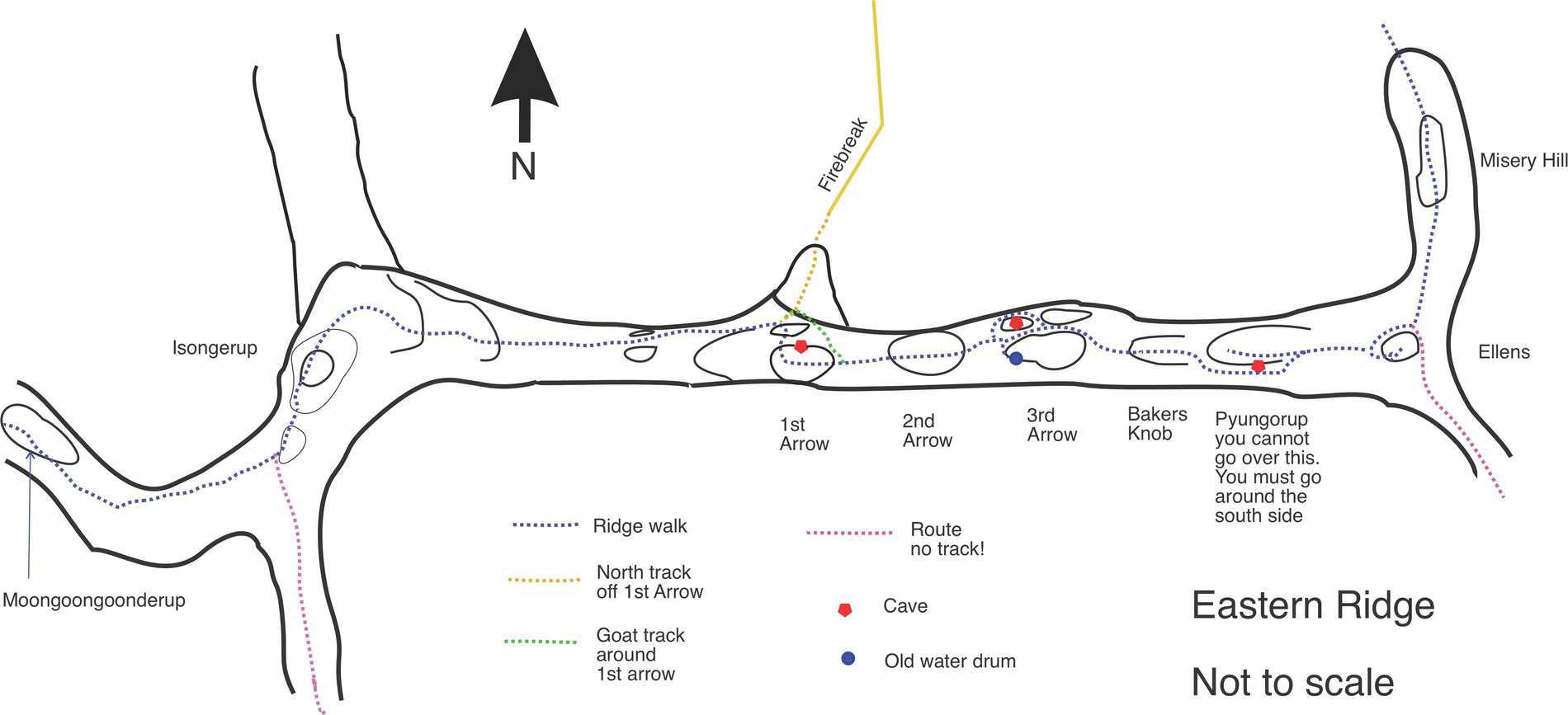
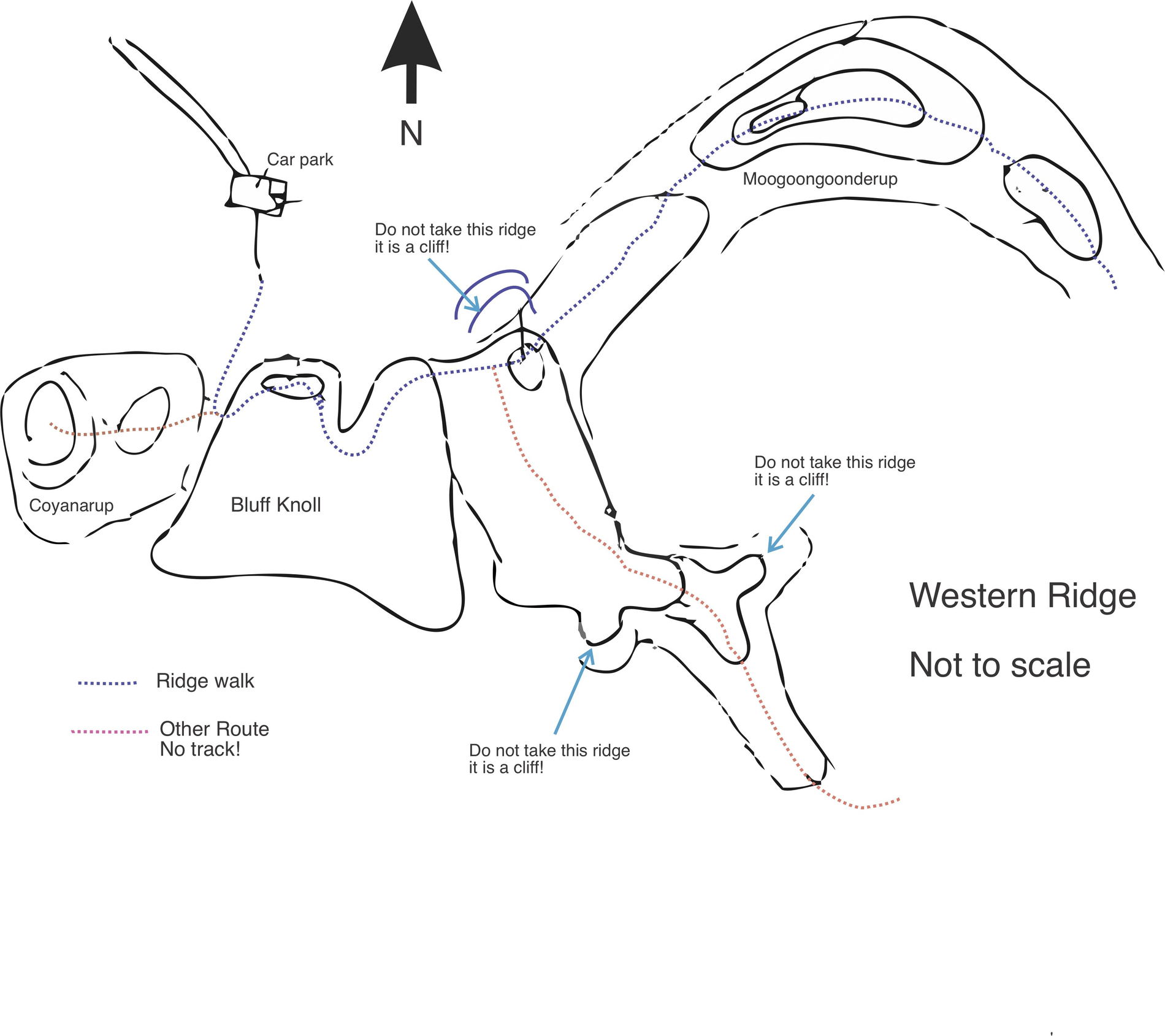
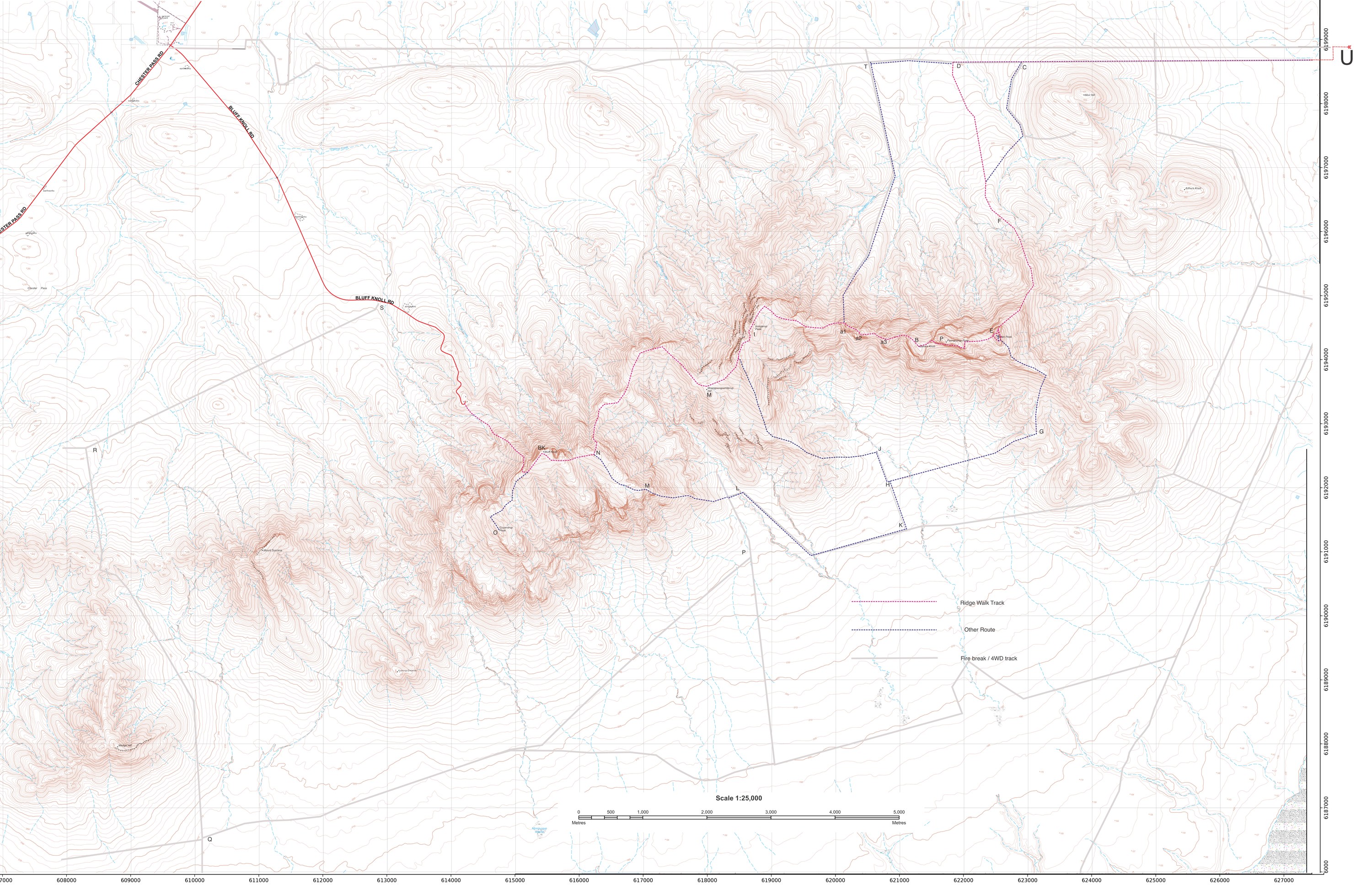
Throughout these notes I use short letter codes for the main peaks and waypoints; they match the lettering on the detailed map below.

BK means Bluff Knoll. The arrows are numbered west to east as a1, a2, a3 (first, second, third arrow).

BK — Bluff Knoll E — Ellen Peak P — Pyungorup B — Bakers Knob a1/a2/a3 — the Arrows I — Isongerup M — Moongoongoonderup O — Coyanorup C — Moir Hill F — Misery Hill T — Northern Plains firebreak L — Moongoongoonderup creek camp D — ridge down off Ellen Peak N — ridge up south side of BK G — clearings (Ellen south approach) H, J, K, Q, R, S — firebreak junctions

Topographic map with routes

Topographic map of the eastern Stirling Range with the Ridge Walk and other routes marked by lettered waypoints
The eastern Stirling Range, with the Ridge Walk (red), other routes (blue) and firebreak / 4WD tracks (grey) marked. Scale 1:25,000. Tap or click to open the large, high-resolution version.

Ridge schematics

Two hand-drawn schematics (not to scale) make the route-finding clearer than the topographic map alone — one for the eastern half of the ridge, one for the west.

Eastern Ridge schematic: Isongerup, the three Arrows, Bakers Knob, Pyungorup, Ellens and Misery Hill, with the ridge walk and side tracks
Eastern Ridge: Isongerup, the three Arrows, Bakers Knob, Pyungorup and Ellen Peak, showing the ridge walk, the north track off the 1st Arrow, the goat track, caves and the old water drum. Tap to enlarge.
Western Ridge schematic: Coyanarup, Bluff Knoll and Moongoongoonderup, with the ridge walk and an untracked route, and cliff warnings
Western Ridge: Coyanarup, Bluff Knoll and Moongoongoonderup, showing the ridge walk (blue) and an untracked route (red). Note the three ridges marked “do not take this ridge — it is a cliff!” Tap to enlarge.